After each trip, the question is always the same, “where are you going next?” My standard answer is, “not sure, but we will know when the time comes.” August 17th was a picture-perfect boating day in northern Michigan. The annual model changeover, dealer show, and photo shoot grind had just wrapped up the prior week and life was slowly getting back to normal. It was a sunny, calm, warm Friday morning and I was in computer hell trying to get a new wireless printer to work. Frustrated and looking out at Burt Lake, I yelled to Karen, “I’ve had it, load up the boat, we are going to the Island!” Thirty minutes later we were underway and after a two hour cruise through the chain of lakes we were tied up at the Pink Pony and sitting at an outdoor table.
.jpg_600.jpg) “This is awesome! How can this be our first trip to Mackinaw this year and why don’t we come more often?” I asked. Patrick Springsteen, a local solo artist with a harmonica, guitar, and an amp entertained us with Bob Seger, Petty and miscellaneous cover tunes. Nearby, boats and kayakers drifted as the ferries were busy bringing tourists to and from the Island. As our waiter dropped off a few tropical drinks, I proudly looked at the sun reflecting off the Cuba pontoon – a 27-foot Avalon Ambassador with twin Merc 400’s – floating mightily behind Patrick who was clicking through the songs. I was immediately in decompression mode. After 30 minutes or so Patrick started to play Gordon Lightfoot’s, The Wreck of the Edmund Fitzgerald and that’s when it hit me. I turned to Karen and said, “I got it, I got the next trip and it’s going to happen soon.” “What?” she said. “Don’t you see? it’s all right here. We have the Cuba boat, we have Lake Superior really close and we get these beautiful high-pressure weeks at the end of the summer and now we have a purpose! We are going to follow the last path of the Edmund Fitzgerald, go to the wreck site and end up right back on our hoist in Burt Lake. It’s perfect. We are going to wait for the right weather and we are going to conquer Lake Superior.”
“This is awesome! How can this be our first trip to Mackinaw this year and why don’t we come more often?” I asked. Patrick Springsteen, a local solo artist with a harmonica, guitar, and an amp entertained us with Bob Seger, Petty and miscellaneous cover tunes. Nearby, boats and kayakers drifted as the ferries were busy bringing tourists to and from the Island. As our waiter dropped off a few tropical drinks, I proudly looked at the sun reflecting off the Cuba pontoon – a 27-foot Avalon Ambassador with twin Merc 400’s – floating mightily behind Patrick who was clicking through the songs. I was immediately in decompression mode. After 30 minutes or so Patrick started to play Gordon Lightfoot’s, The Wreck of the Edmund Fitzgerald and that’s when it hit me. I turned to Karen and said, “I got it, I got the next trip and it’s going to happen soon.” “What?” she said. “Don’t you see? it’s all right here. We have the Cuba boat, we have Lake Superior really close and we get these beautiful high-pressure weeks at the end of the summer and now we have a purpose! We are going to follow the last path of the Edmund Fitzgerald, go to the wreck site and end up right back on our hoist in Burt Lake. It’s perfect. We are going to wait for the right weather and we are going to conquer Lake Superior.”
I then thought to myself, “this trip is going to be different from all the others.” We have always had a destination which required significant travel planning, so we have always also had to pick the dates well in advance. On each of the previous seven excursions (even Southern California where it never rains), we have always been faced with major weather events. I ended with, “this time it’s going to be about watching the weather and waiting for the right time to go as we surely don’t want to end up at the bottom as the Fitz did.”
The Edmund Fitzgerald
.jpg_600.jpg) Anyone growing up in Michigan has heard the song a thousand times. Lightfoot wrote the song as a tribute to the ship’s crew, as all 29 men died aboard the ship without so much as a distress call. From the song I knew it was one of the biggest freighters on the Great Lakes; I knew that it battled an early November gale with freezing rain in the face of a hurricane west wind; I knew that the searchers all say they’d have made Whitefish Bay if they’d put 15 more miles behind her and I knew from the last line of the song, “Superior, they said, never gives up her dead when the gales of November come early.” After returning from Mackinaw I jumped on the Internet to learn more. After a bit of digging, I learned that the Ojibwa natives called Lake Superior Gitche Gumee, which means Big Sea Water. I learned that the large cargo vessels that roamed the five Great Lakes were known as “Lakers,” and the S.S. Edmund Fitzgerald was, at the time, the biggest ever built. The Laker was 729 feet in length, sat 39 feet high with a width of 75 feet and weighed more than 13,000 tons without cargo. The Soo Locks, at that time, were 730 feet in length so the ship was built to 729 feet to maximize its hauling capacity. The Fitz was christened on June 8, 1958 and made its first voyage in September of that same year. It was commissioned and owned by Northwestern Mutual Insurance Company at a cost of $8.4 million and was named after the Chairman of the Board – Mr. Edmund Fitzgerald. On November 9, 1975 the Fitz was loaded with 26,116 tons of iron ore pellets at the Burlington Northern Railroad Dock in Superior, Wis., and it left the dock at 2:30 p.m. A second ship, the Arthur M. Anderson sailed 10 to 15 miles behind the Fitzgerald as a precaution, and the two ships remained in radio contact until just after 7 p.m. on November 10th. The swells reached 35 feet and winds raged at nearly 100 mph. The ship contacted Coast Guard officials in Sault Ste. Marie and said they were taking on water. Captain Ernest McSorley was on his final voyage before retirement. He assured a crew member on the Anderson at 7:10 that evening, “We are holding our own” and that was the last anyone heard from McSorley or the Fitzgerald. The exact cause of the sinking remains unknown, though many books, studies, and expeditions have examined it. The Fitzgerald may have been swamped, suffered structural failure or topside damage, been shoaled, or suffered from a combination of these. The freighter now lays on the bottom of Lake Superior in two sections, at a depth of 535 feet, at 46 degrees 59’54.59” N - 85 degrees 06’36.00” W, which was approximately 17 miles northwest of Whitefish Point. I also found it interesting to learn that the lake really doesn’t give up its dead easily because the water is so cold that bacterial action is inhibited. The bodies sink and don’t float.
Anyone growing up in Michigan has heard the song a thousand times. Lightfoot wrote the song as a tribute to the ship’s crew, as all 29 men died aboard the ship without so much as a distress call. From the song I knew it was one of the biggest freighters on the Great Lakes; I knew that it battled an early November gale with freezing rain in the face of a hurricane west wind; I knew that the searchers all say they’d have made Whitefish Bay if they’d put 15 more miles behind her and I knew from the last line of the song, “Superior, they said, never gives up her dead when the gales of November come early.” After returning from Mackinaw I jumped on the Internet to learn more. After a bit of digging, I learned that the Ojibwa natives called Lake Superior Gitche Gumee, which means Big Sea Water. I learned that the large cargo vessels that roamed the five Great Lakes were known as “Lakers,” and the S.S. Edmund Fitzgerald was, at the time, the biggest ever built. The Laker was 729 feet in length, sat 39 feet high with a width of 75 feet and weighed more than 13,000 tons without cargo. The Soo Locks, at that time, were 730 feet in length so the ship was built to 729 feet to maximize its hauling capacity. The Fitz was christened on June 8, 1958 and made its first voyage in September of that same year. It was commissioned and owned by Northwestern Mutual Insurance Company at a cost of $8.4 million and was named after the Chairman of the Board – Mr. Edmund Fitzgerald. On November 9, 1975 the Fitz was loaded with 26,116 tons of iron ore pellets at the Burlington Northern Railroad Dock in Superior, Wis., and it left the dock at 2:30 p.m. A second ship, the Arthur M. Anderson sailed 10 to 15 miles behind the Fitzgerald as a precaution, and the two ships remained in radio contact until just after 7 p.m. on November 10th. The swells reached 35 feet and winds raged at nearly 100 mph. The ship contacted Coast Guard officials in Sault Ste. Marie and said they were taking on water. Captain Ernest McSorley was on his final voyage before retirement. He assured a crew member on the Anderson at 7:10 that evening, “We are holding our own” and that was the last anyone heard from McSorley or the Fitzgerald. The exact cause of the sinking remains unknown, though many books, studies, and expeditions have examined it. The Fitzgerald may have been swamped, suffered structural failure or topside damage, been shoaled, or suffered from a combination of these. The freighter now lays on the bottom of Lake Superior in two sections, at a depth of 535 feet, at 46 degrees 59’54.59” N - 85 degrees 06’36.00” W, which was approximately 17 miles northwest of Whitefish Point. I also found it interesting to learn that the lake really doesn’t give up its dead easily because the water is so cold that bacterial action is inhibited. The bodies sink and don’t float.
The Plan
By the end of that same mid-August weekend I knew where we would start (Superior, Wis.,) where we would stay (Copper Harbor, Grand Marias, Mackinaw Island), distance between planned fuel stops, location of the Edmund Fitzgerald, provisions and safety supplies needed, etc. I reached out to my neighbor, who is very well connected with the Coast Guard. He put me in contact with the Sector Commander from Sault Saint Marie who in turn put me into contact with CW04 Scott Harroun (Senior Marine Inspector based out of Duluth, Minn.) Scott was helpful in putting Lake Superior in perspective and blunt when talking about the safety considerations. Lake Superior is the largest of all the Great Lakes. It is the largest freshwater lake in the world based on surface area (31,700 square miles) and reaches 1,332 feet at its deepest point. The average annual temperature of the lake is 40 degrees. In September, the average temperature is in the mid 50’s. .jpg_600.jpg) Should anything go wrong, hypothermia would be our biggest risk factor. Initial symptoms of hypothermia can start within 30 minutes, eventually leading to disorientation and a loss of consciousness. Scott stated we would be on our own and needed to plan to survive for up to two and a half hours between the distress call and any type of meaningful response. The long response time was due to the sheer size of the lake and the fact that the air base was in Sault Saint Marie and they would have to refuel in Duluth before attempting a rescue in the western or central areas of Superior. In addition to the standard items in our ditch bag (EPIRB, spot satellite messenger, personal locator beacons, strobes, handheld marine radios, flashlights, etc.), it was apparent that a life raft and dry suits were a must for this journey. We also discussed the lack of cell service and the benefits of having a satellite phone, or other forms of communication, in addition to the standard marine radio. Float plan, Coast Guard input, safety equipment – “check.” The boat would be the 27-foot Avalon Ambassador with twin Mercury racing engines that we had taken from Clearwater, Fla., to Cuba in June of 2017. The boat was a stock boat other than the addition of a second 100-gallon fuel tank, giving the boat a range of 200 plus miles.
Should anything go wrong, hypothermia would be our biggest risk factor. Initial symptoms of hypothermia can start within 30 minutes, eventually leading to disorientation and a loss of consciousness. Scott stated we would be on our own and needed to plan to survive for up to two and a half hours between the distress call and any type of meaningful response. The long response time was due to the sheer size of the lake and the fact that the air base was in Sault Saint Marie and they would have to refuel in Duluth before attempting a rescue in the western or central areas of Superior. In addition to the standard items in our ditch bag (EPIRB, spot satellite messenger, personal locator beacons, strobes, handheld marine radios, flashlights, etc.), it was apparent that a life raft and dry suits were a must for this journey. We also discussed the lack of cell service and the benefits of having a satellite phone, or other forms of communication, in addition to the standard marine radio. Float plan, Coast Guard input, safety equipment – “check.” The boat would be the 27-foot Avalon Ambassador with twin Mercury racing engines that we had taken from Clearwater, Fla., to Cuba in June of 2017. The boat was a stock boat other than the addition of a second 100-gallon fuel tank, giving the boat a range of 200 plus miles.
Next on the agenda was to send an email to the Cuba Crew (Doug Haskell and Travis Conners (Michigan based Avalon and Tahoe dealers) and Charlie Chiara (owner of Clearstream Media based in Los Angeles, Calif., and video/digital partner for past 10 plus years) apprising them of the plan. Trying to coordinate potential time frames, Travis and Charlie were quick to respond with their prior obligations over the next few weeks. We potentially had the next four or five weeks to work with before the window of opportunity closed for the season. Charlie was due in New York City from the 6th to the 13th and would bring his equipment east with him. Travis had an in-house boat show planned for the weekend of Sept. 14th. Based on their availability we settled on Sunday, September 16th as our drive day with departure from Superior, Wis., the following morning.
 We planned to be back to Burt Lake by Wednesday the 19th. “Where’s Doug?” I thought. Doug has been my first mate since I started doing these long-distance pontoon trips in November of 2004 when we took our first trip from Baltimore, Md., to Key West, Fla. Since then, we’ve completed seven excursions and he’s typically quick to respond. This time was different. A few days later, and after more text messages, emails and phone calls, Doug finally called. I could tell something wasn’t right by the time he said, “Hello.” He hesitated and then broke the news. “Remember our last trip to Cuba?” “How could I forget,” I replied. “Well, before I left for Florida, my wife asked me to promise her that it would be the last one.” “And?” I asked. “I promised, and I have to keep the promise I made to her,” he said. We chatted for a long while and reminisced the good times. He wished us luck and said he would be tracking the journey. Hanging up the phone I marched over to Duane Dinninger’s office and told him that he was going with us. Duane is my right-hand man, long-time high school buddy and lifelong boater. Also, boat smart, mechanically inclined and was one of the crew on our Pacific excursion in 2015. Boat and crew – “check.” It was game on.
The Countdown
Monday, September 10th, seven days before scheduled launch, I started looking at NOAA marine forecasts, local weather reports, etc. Things were looking stellar for the next several days, however, things were due to take a turn for the worse sometime the following weekend.
“It’s still a long way out,” I kept telling myself. Going through the same routine the following morning things were looking worse. Over the next four or five days the forecasts were all showing five to 15 mph, south/southwest winds with waves 1 to 3 feet. Five to six days out, winds were going to shift to north/northeast with increasing winds and waves building to 3 to 5 feet. I thought to myself, “Damn!!! This time it is supposed to be about safety, going when the weather is right and not sticking with firm dates.” Over the next few hours, I kept staring at the same thing. It was noon and time to go to lunch when I made the decision. I called Duane in the office and said, “We have to go now. We will drive to Burt tonight, have Harold Reckinger drive us to Superior tomorrow, and we will launch Thursday morning.”
 After showing the forecasts to Duane, he agreed. Decision made. I called Charlie and Travis to see if they could rearrange their schedules, which neither could do. Next call was to John Linn who lives in Brainerd Minn., and shoots all of our still photography. I first met John when he was “on assignment” to document our second excursion trip from Chicago to Mackinaw in June of 2006. John, who has been our photographer ever since, is a dear friend and would be a good replacement for Charlie. “Can you meet me in Superior tomorrow night to take a ride across Lake Superior?” John replied with, “Sure, but first I have an all-day shoot tomorrow here in Brainerd. I’ll get there one way or the other.” The balance of my afternoon was focused on the new plan. With help from a few of my guys, we worked to expedite the satellite phone, life raft and dry suits from the rental companies.
“Have them ship it overnight direct to Barker’s Island Resort in Superior, call Travis and have his guys pull and prep the boat, get a hold of our driver Harold and tell him we are on the road by 10 a.m.!!!” I barked. After wrapping up some office work, I left the office around 8 p.m. for the two-hour drive north. Duane would drive up from his home in Grand Rapids in the morning. Excited and on my way north, I kept thinking it sure would be nice to find a fourth crew member. Three is okay, but four is always better. The six or seven calls to friends and potential crew members proved fruitless due to the short notice. “Yes, tomorrow morning,” I kept saying to each one of them. I finally crawled into bed at 2 a.m. after testing and packing up the safety equipment, trip provisions, etc. Checked the weather one final time, unchanged, lights out.
Travel Day Indian River, Mich., To Superior, Wis.,: 9h:34m, 441.4 miles
.jpg_600.jpg) Up by 6:30 a.m., I finished packing, loaded the car and awaited Duane’s pre-planned 8 a.m. arrival. We would drive the 3 miles to Indian River Sports Center where the truck and trailer would be waiting. As Duane was running 30 minutes late, I decided to go to the store for ice and some other needed essentials. On the way, the phone rang, and it was Scott Foresmark, who lives year-around on Burt Lake, runs a dental practice in Cheboygan, is a weekend boating companion and was on my short list of calls the prior night. “What’s up Scott?” I ask. He replies, “I’m with my first patient at the office, but I’ve been up all-night thinking about the trip you are going on. What time are you leaving?” “In about an hour or an hour and a half, I replied. “I’ll leave now, go home and grab a few things and will meet you at Travis’s shop,” he said. “Awesome!!! I’ll see you there!” I must have been grinning from ear-to-ear and thinking this was meant to be. We have our fourth and he will be a “value added” crew member, especially if we have any medical or dental issues along the way. Duane parked his car in my garage, I gave him a quick tour and we were off. It’s always busy at Indian River Sports Center and as we pulled in, there was a flurry of activity. Forklifts and yard trailers were moving boats, hoists and PWCs around and I saw the Cuba boat loaded on the trailer and ready to go. Travis was still loading a few last-minute items including spare props, oil filters, etc. He said the inflatable paddle board, extra fuel cans, anchor and lines, bumpers and Mustang Survival life vests were on board and secured. I thanked him for all his help and asked him one last time if he could come along and blow off his big boat show. We both knew the answer and with that, we loaded ourselves into the dually and were off. After 20 minutes up I-75 we crossed over the Mackinaw Bridge with Mackinaw Island in the distance. The Straights of Mackinaw were calm, the sun was bright and the air warm.
Up by 6:30 a.m., I finished packing, loaded the car and awaited Duane’s pre-planned 8 a.m. arrival. We would drive the 3 miles to Indian River Sports Center where the truck and trailer would be waiting. As Duane was running 30 minutes late, I decided to go to the store for ice and some other needed essentials. On the way, the phone rang, and it was Scott Foresmark, who lives year-around on Burt Lake, runs a dental practice in Cheboygan, is a weekend boating companion and was on my short list of calls the prior night. “What’s up Scott?” I ask. He replies, “I’m with my first patient at the office, but I’ve been up all-night thinking about the trip you are going on. What time are you leaving?” “In about an hour or an hour and a half, I replied. “I’ll leave now, go home and grab a few things and will meet you at Travis’s shop,” he said. “Awesome!!! I’ll see you there!” I must have been grinning from ear-to-ear and thinking this was meant to be. We have our fourth and he will be a “value added” crew member, especially if we have any medical or dental issues along the way. Duane parked his car in my garage, I gave him a quick tour and we were off. It’s always busy at Indian River Sports Center and as we pulled in, there was a flurry of activity. Forklifts and yard trailers were moving boats, hoists and PWCs around and I saw the Cuba boat loaded on the trailer and ready to go. Travis was still loading a few last-minute items including spare props, oil filters, etc. He said the inflatable paddle board, extra fuel cans, anchor and lines, bumpers and Mustang Survival life vests were on board and secured. I thanked him for all his help and asked him one last time if he could come along and blow off his big boat show. We both knew the answer and with that, we loaded ourselves into the dually and were off. After 20 minutes up I-75 we crossed over the Mackinaw Bridge with Mackinaw Island in the distance. The Straights of Mackinaw were calm, the sun was bright and the air warm..jpg_600.jpg) “Wow,” I said. “This is a picture-perfect day to be on the water boys.” The 440-mile ride across the Upper Peninsula was long. A short while later we made it a point to stop at Gustafson’s, which is well known for their beef jerky and smoked fish. The ride was filled with work calls, Tom Petty on XM radio, high school stories and last-minute trip planning. At one point, I was thinking it had been less than 24 hours since we decided to fast-track the trip and here we were, three hours down the road. I was reading more about the Edmund, Lake Superior, etc., when a thought crossed my mind. I called Dalton Sheldon back at the plant and asked him to find a flower shop in Superior that would deliver 29 roses (with the names of each crew member stapled to each stem) to Barkers Island Resort. A few fuel stops and nine hours later we rolled into Superior with a windshield full of bugs and a 27-foot Ambassador in tow. We went quickly to the boat ramp right next door to Barkers as the sun was setting. Duane and I secured the boat in a convenient slip while Harold and Scott checked into the hotel. We had dinner and drinks in the bar while watching the coverage of Hurricane Florence, which was battering the North Carolina coast. Before too long we all retired to our respective rooms with a call time of 7 a.m. TV on, hurricane aftermath, stories on the news with Coast Guard rescues at sea, what will this trip bring? Lights out.
“Wow,” I said. “This is a picture-perfect day to be on the water boys.” The 440-mile ride across the Upper Peninsula was long. A short while later we made it a point to stop at Gustafson’s, which is well known for their beef jerky and smoked fish. The ride was filled with work calls, Tom Petty on XM radio, high school stories and last-minute trip planning. At one point, I was thinking it had been less than 24 hours since we decided to fast-track the trip and here we were, three hours down the road. I was reading more about the Edmund, Lake Superior, etc., when a thought crossed my mind. I called Dalton Sheldon back at the plant and asked him to find a flower shop in Superior that would deliver 29 roses (with the names of each crew member stapled to each stem) to Barkers Island Resort. A few fuel stops and nine hours later we rolled into Superior with a windshield full of bugs and a 27-foot Ambassador in tow. We went quickly to the boat ramp right next door to Barkers as the sun was setting. Duane and I secured the boat in a convenient slip while Harold and Scott checked into the hotel. We had dinner and drinks in the bar while watching the coverage of Hurricane Florence, which was battering the North Carolina coast. Before too long we all retired to our respective rooms with a call time of 7 a.m. TV on, hurricane aftermath, stories on the news with Coast Guard rescues at sea, what will this trip bring? Lights out.
Day One Superior To Copper Harbor: 10h:17m, 220.15 mi
Up early, game on. Need to get out of the room, grab the life raft, survival suits and flowers from the front desk and get them on the boat before hooking up with Maria Lockwood from the Superior Telegram. Oh yeah, our Coast Guard contact, Scott, is en route too. Getting the boat situated with the sun rising, John appeared out of nowhere with his wife Carna in tow. With a big grin, John says, “Morning fellas, how are we?” “Mighty fine and what time did you have to get on the road?” I asked. “At 4 a.m. and my wife is a trooper to have gotten me here right on time,” he replied. As we were stowing his dry bags and camera gear the phone rang and Scott asked where we were located. “Right out front, can’t miss us, I see you pulling in,” I said. Coast Guard Scott came aboard to check out the rig while John immediately went to work with his camera. After 20 minutes or so Scott and Carna were on their way and we were sitting down for breakfast with Maria from the Superior Telegram. After some breakfast and questions about why we do these trips, pontoon boats, the Fitzgerald, etc., we were off. There were hugs and goodbyes to our driver Harold as I thought to myself, “I’m sure glad to be going back by boat than by car!” We coordinated with Maria and Harold to take a few photos, past the loading docks, on the break wall on our way out. As we idled out of the Barkers marina, John was hell-bent on showing us his latest toy, which was some state-of-the-art camera mount that apparently was going to make us all pretty. It’s 9:30 a.m. and we are finally on our way! Exhilaration and excitement set in as we passed Maria and Harold on the way out. It was a balmy 80 plus degree day, the seas were calm, we have our four-man crew, 220 gallons of fuel and two 400hp Mercury’s pushing us out to sea. As we passed the lighthouse at the end of the inlet, I thought to myself, “Wow this is really happening.”
.jpg_600.jpg) Our first destination was 50 miles up the shoreline to the Bayfield Peninsula sea caves located a few miles past Bark Point. John had done some previous photo shoots in the area and knew exactly where to go. We played around for 45 minutes or so as we took photos, flew the drone and soaked up the natural beauty of the cliffs, rock formations and caves. We were awestruck as we tried to take it all in. It was truly an awesome experience and a great way to start the trip. Next, we navigated through the Apostle Islands. The Apostle Islands is an archipelago of 22 islands located in Lake Superior off the Bayfield Peninsula. Twenty-one of these islands, and a 12-mile segment along the shore of Wisconsin’s north coast, is known as the Apostle Islands National Lakeshore. Paying close attention to the weather, we knew the winds were picking up to 10 to 15 mph south/southwest and that waves could be a challenge as we crossed the open water towards Ontonagon which was our first scheduled fuel stop. We pondered sticking close to the southern shore, but after going offshore five or ten miles with manageable seas, we decided to go straight across towards the Porcupine Mountains on the eastern shore, which was a 40 plus mile open water run. We hit a few sections of 3- to 5-foot waves during the crossing, but all in all it was a fun ride to the other shore. Once there, we cruised in close to shore and idled along the calm shoreline, took more photos and grabbed a few snacks. The water color changed from blue to brown as we entered the Ontonagon inlet. A few miles up stream we located the fuel dock which was closed, but had a number to call. Fifteen minutes later Joe showed up, unlocked the pump and filled us up. Meanwhile John played with his drone as the rest of us got the lowdown on the local fishing techniques. Back in the blue water, we had another 100 miles of coastline running to get to Copper Harbor, so we put the hammer down. As Duane was at the wheel, I called Dalton back at the office to help us find a few rooms for the night.
Our first destination was 50 miles up the shoreline to the Bayfield Peninsula sea caves located a few miles past Bark Point. John had done some previous photo shoots in the area and knew exactly where to go. We played around for 45 minutes or so as we took photos, flew the drone and soaked up the natural beauty of the cliffs, rock formations and caves. We were awestruck as we tried to take it all in. It was truly an awesome experience and a great way to start the trip. Next, we navigated through the Apostle Islands. The Apostle Islands is an archipelago of 22 islands located in Lake Superior off the Bayfield Peninsula. Twenty-one of these islands, and a 12-mile segment along the shore of Wisconsin’s north coast, is known as the Apostle Islands National Lakeshore. Paying close attention to the weather, we knew the winds were picking up to 10 to 15 mph south/southwest and that waves could be a challenge as we crossed the open water towards Ontonagon which was our first scheduled fuel stop. We pondered sticking close to the southern shore, but after going offshore five or ten miles with manageable seas, we decided to go straight across towards the Porcupine Mountains on the eastern shore, which was a 40 plus mile open water run. We hit a few sections of 3- to 5-foot waves during the crossing, but all in all it was a fun ride to the other shore. Once there, we cruised in close to shore and idled along the calm shoreline, took more photos and grabbed a few snacks. The water color changed from blue to brown as we entered the Ontonagon inlet. A few miles up stream we located the fuel dock which was closed, but had a number to call. Fifteen minutes later Joe showed up, unlocked the pump and filled us up. Meanwhile John played with his drone as the rest of us got the lowdown on the local fishing techniques. Back in the blue water, we had another 100 miles of coastline running to get to Copper Harbor, so we put the hammer down. As Duane was at the wheel, I called Dalton back at the office to help us find a few rooms for the night. .jpg_600.jpg) He called back with a few suggestions, one of which was the Mariner North Resort. I recalled Harold mentioning this place to me during our drive across the Upper Peninsula. I told Dalton to rent two cabins and to send me a contact number. At that time, he informed me that the one thing about Copper Harbor is they have no cellular service in the entire town. I called the number provided to let them know what time we would be arriving and inquired about transportation from the marina to the resort which was two or so miles away. The owner Peggy said she would come down and get us. After a few calculations, I told her to expect us at around 8 p.m. About halfway from Ontonagon to Copper Harbor we passed the Houghton Inlet. There were several boats anchored along the shore as fellow-boaters were soaking up the last of the warm rays on what felt like a mid-July summer day. With John working the videos and stills, we took a few passes by the lighthouse markers that flanked the mouth of the inlet. The final push to Copper Harbor was smooth and fast with plenty of impressive rock formations coupled with natural beaches to gaze at along the way. As we turned into Copper Harbor it was apparent we were heading west due to a blinding ball of fire low in the sky. The marina is at the very end of the harbor where Peggy was waiting for us at the boat ramp. Unloading the gear, we quickly realized that two trips would be required.
He called back with a few suggestions, one of which was the Mariner North Resort. I recalled Harold mentioning this place to me during our drive across the Upper Peninsula. I told Dalton to rent two cabins and to send me a contact number. At that time, he informed me that the one thing about Copper Harbor is they have no cellular service in the entire town. I called the number provided to let them know what time we would be arriving and inquired about transportation from the marina to the resort which was two or so miles away. The owner Peggy said she would come down and get us. After a few calculations, I told her to expect us at around 8 p.m. About halfway from Ontonagon to Copper Harbor we passed the Houghton Inlet. There were several boats anchored along the shore as fellow-boaters were soaking up the last of the warm rays on what felt like a mid-July summer day. With John working the videos and stills, we took a few passes by the lighthouse markers that flanked the mouth of the inlet. The final push to Copper Harbor was smooth and fast with plenty of impressive rock formations coupled with natural beaches to gaze at along the way. As we turned into Copper Harbor it was apparent we were heading west due to a blinding ball of fire low in the sky. The marina is at the very end of the harbor where Peggy was waiting for us at the boat ramp. Unloading the gear, we quickly realized that two trips would be required. .jpg_600.jpg) John and Scott took the first load while Duane and I moved and secured the boat in one of the many available slips. Peggy was back in no-time. We dropped bags off at our rooms and quickly made our way to the restaurant as they stopped serving at 9 p.m. A few steaks and drinks later we were ready to call it a night. We talked to Peggy about giving us a ride back in the morning around 7 a.m., which she was not really keen to do. Instead, she said, “Why don’t you take my car and leave it at the marina. I always leave it unlocked with the keys in it, this is, after all, Copper Harbor.”
John and Scott took the first load while Duane and I moved and secured the boat in one of the many available slips. Peggy was back in no-time. We dropped bags off at our rooms and quickly made our way to the restaurant as they stopped serving at 9 p.m. A few steaks and drinks later we were ready to call it a night. We talked to Peggy about giving us a ride back in the morning around 7 a.m., which she was not really keen to do. Instead, she said, “Why don’t you take my car and leave it at the marina. I always leave it unlocked with the keys in it, this is, after all, Copper Harbor.”
Day Two Copper Harbor To Grand Marais: 11h:41m, 146.96 mi
Call time was 6:30 a.m. Laying in bed at 6:10 a.m., I immediately noticed the curtains that covered the screened window were blowing and weaving. First slowly and then more violently. “Not good,” I thought. I tried recalling the last time I had checked the NOAA weather report and remembered it was in the Apostle Islands. At that time everything was smooth sailing and now at 6 a.m., it’s blowing sideways. Concerned, I jumped out of bed and into the shower. Outside was more of the same with the tree tops blowing from side to side and the flags standing straight out. Duane was looking at the wind report on his phone and said it was currently blowing 16 knots, building to 20 knots and then tapering off around 1 p.m. The winds were south/southwest, which meant we would be taking them head-on once we rounded the tip of the Keweenaw Peninsula which was approximately 15 miles to our east. Locating Peggy’s car parked around the corner I slowly opened the door and looked around to make sure I found the right one. I recognize a pair of shoes sitting between the rear bucket seats which provided some relief that I wouldn’t be doing time for grand theft. Using the push button to start it, I wheeled it around to our drive. Entering the second cabin, I found John at the kitchen table intently working on something. He explained he was making fresh “pressed” coffee which I had never seen before. With coffee in hand, we loaded into the car and made a quick stop at the Copper Harbor sign to get a group picture on the way into the marina..jpg_600.jpg) With the boat loaded and Peggy’s car sitting solo in the parking lot, we pushed off with the sun rising below a bank of dark billowing clouds. We passed and waved to the patrons on a ferry boat as we made our way towards the jetty. Back in the open water with the shore off the starboard side, we cruised along at 15 to 18 mph for four or five miles as we sipped our pressed coffee and checked the weather reports. During dinner the night before, John pulled up the Wikipedia page for the Standard Rock Lighthouse. I was intrigued when I read that the Standard Rock Light, completed in 1883, is a lighthouse located on a reef that was the most serious hazard to navigation on Lake Superior. The exposed crib of the Stannard Rock Light is rated as one of the top ten engineering feats in the United States. It is 24 miles from the nearest land, making it the most distant lighthouse in the United States. It was one of the “stag stations,” manned only by men, and had the nickname, “The Loneliest Place in the World.” Our plan was to go there, but not now, not with this wind. As things stand it’s going to be a really long day! We debated if we should hug the shore down towards Marquette or if we should make a straight line to Munising. We decided to wait and see what the conditions would bring once we got around the peninsula. I pondered the fact that we were unable to refuel in Copper Harbor as the fuel dock did not open until 9 a.m. this late in the season and calls to see if we could have someone come in early went unanswered. The one-third rule (one-third out, one-third back, one-third in reserve) will not apply today and according to our estimates, we would be cutting it close. “Ready boys?” I asked. Bringing the boat up to speed, it suddenly stuttered and slowed a bit. For a second it felt like we may have hit something, but then quickly realized that we had “spun a hub.” When you spin a hub, as we did on our Bimini excursion, you must replace the hub kit by removing or replacing the prop. We learned a valuable lesson in the Gulf Stream and have brought a spare along ever since. Turning the boat around I was thinking we would have to idle the five miles or so back to Copper Harbor to find a convenient location to swap out the props. Scanning the shoreline there were a lot of rock outcrops 75 to 100 yards off shore. Noticing a few areas where no rocks were visible, we headed in and made our way to the rocky shore. Using the anchor lines, we were able to spin the boat around to get the back of the boat close enough to shore to make the change.
With the boat loaded and Peggy’s car sitting solo in the parking lot, we pushed off with the sun rising below a bank of dark billowing clouds. We passed and waved to the patrons on a ferry boat as we made our way towards the jetty. Back in the open water with the shore off the starboard side, we cruised along at 15 to 18 mph for four or five miles as we sipped our pressed coffee and checked the weather reports. During dinner the night before, John pulled up the Wikipedia page for the Standard Rock Lighthouse. I was intrigued when I read that the Standard Rock Light, completed in 1883, is a lighthouse located on a reef that was the most serious hazard to navigation on Lake Superior. The exposed crib of the Stannard Rock Light is rated as one of the top ten engineering feats in the United States. It is 24 miles from the nearest land, making it the most distant lighthouse in the United States. It was one of the “stag stations,” manned only by men, and had the nickname, “The Loneliest Place in the World.” Our plan was to go there, but not now, not with this wind. As things stand it’s going to be a really long day! We debated if we should hug the shore down towards Marquette or if we should make a straight line to Munising. We decided to wait and see what the conditions would bring once we got around the peninsula. I pondered the fact that we were unable to refuel in Copper Harbor as the fuel dock did not open until 9 a.m. this late in the season and calls to see if we could have someone come in early went unanswered. The one-third rule (one-third out, one-third back, one-third in reserve) will not apply today and according to our estimates, we would be cutting it close. “Ready boys?” I asked. Bringing the boat up to speed, it suddenly stuttered and slowed a bit. For a second it felt like we may have hit something, but then quickly realized that we had “spun a hub.” When you spin a hub, as we did on our Bimini excursion, you must replace the hub kit by removing or replacing the prop. We learned a valuable lesson in the Gulf Stream and have brought a spare along ever since. Turning the boat around I was thinking we would have to idle the five miles or so back to Copper Harbor to find a convenient location to swap out the props. Scanning the shoreline there were a lot of rock outcrops 75 to 100 yards off shore. Noticing a few areas where no rocks were visible, we headed in and made our way to the rocky shore. Using the anchor lines, we were able to spin the boat around to get the back of the boat close enough to shore to make the change.  Unable to locate the prop wrench that Travis said he had put onboard, we used John’s handheld Garmin inReach that had two-way texting to contact Travis. Travis quickly replied that the prop wrench was in one of the two prop boxes. Twenty minutes later we were navigating our way back to open water. Rounding the tip of the Keweenaw Peninsula the wind and waves hit us straight in the face. Three- to 5-foot waves in the typical tight Great Lakes wave pattern proved to be a challenge. Winds were gusting at 20 knots and were not scheduled to subside for several hours. We kept moving and continued debating our best path given the conditions. After 45 minutes we were 15 miles off shore on a heading direct to Munising. After another hour, land started to slowly disappear on the horizon as we battled the waves. With one hand on the throttles and the other on the wheel, I worked to avoid taking waves over the bow while minimizing the banging on the way down. We were averaging 15 to 18 mph and had 90 plus miles to go. Another few hours, and past the halfway point on the Garmin GPS, the pressed coffee had gotten to me and I could wait no longer. I turned so the waves would hit us from the side and pulled back on the throttle. The guys started barking at me, “What’s wrong, what are you doing,” as a few waves came over the front of the boat and water flowed through. “I gotta go, but this isn’t gonna work, we need to keep moving,” I replied. John took the wheel, gave it some gas to get on top of the waves again and resumed our heading while I made my way to the back of the boat. Kneeling at the back door and trying to hold on, I took care of business. As I was going, with a grin, I was thinking of our flooring suppliers claim that the flooring is resistant to stains and easy to clean. At some point 30 or so miles from shore the waves started laying down a bit and we were able to ramp our speed up to 30 plus. We were wet, cold and tired as Grand Island came into view. I was keeping an eye on the fuel and we were now down to our last two bars on the digital gauge. After the slow four hour ride, we wanted to go faster, but kept it at a modest 35 plus mph speed to conserve fuel. We could see the larger rock formations on the northwest side of the Island when we were four to five miles out. Once there we stayed close to shore checking out the towering walls of rock as we made our way around the east side of the island. A few years back we took a few summer PWC vacations to the Munising area and I knew the area well. I made a point to stop at “my happy place” which is a secluded beach on the north side of the island. Pulling into the beach you feel as though you are on a deserted Caribbean island with crystal clear blue water and pure nature as far as the eye can see. We enjoyed drying out a bit while munching on some chips and dip, and took some more photos. After the short 30 minute break, we resumed our tour around the island. We arrived at the Munising fuel dock with just over 15 gallons in reserve. While fueling Scott and John walked into town to pick up a few Subway sandwiches for lunch. With the sun beating down we sat at a shaded picnic table in the park. We talked about the pounding we had just taken and the fact that we were all glad to be on dry land at that moment. Back at the dock, we reorganized the cargo while a shirtless John was pumping the WOW inflatable paddleboard that Travis had put aboard. John would use the board to shoot from at our next stop, Pictured Rocks National Lakeshore, which stretches for 42 miles and begins just a few miles outside of town.
 .jpg_600.jpg) We departed the marina at 4:15 p.m. and spent the next three hours taking photos, exploring and relaxing while taking in the splendor and awe of the area on a picture-perfect afternoon. A few highlights were backing into a cave, spotting a picture of what looked like David Garcia, and putting the bow of the pontoon into a 200-foot-tall waterfall. After a quick swim, we decided that it was time to put some more miles behind us. Given the slow go in the morning, we had to readjust our plans and decided that it would make sense to spend the night in Grand Marais. I dialed up Dalton and asked him to call around to negotiate four rooms for the night. The Beach Park Hotel gave us a good deal and the owner offered to come down to the marina to pick us up upon our arrival. With a nearly full tank of gas, we went wide open and cranked up the music for the hour ride. The sun was going down as we made our way and the high-performance Infinity speakers were blaring. Listening to Seal, I had to smile when I heard the lyrics, “But we’re never gonna survive unless we get a little crazy, no we’re never gonna survive unless we’re a little crazy.” We tied up, called John, the hotel owner, for a ride and started gathering our bags. The hotel was only a few blocks away and as we pulled in a huge fireworks show started going off right in front of the hotel and over the bay. I joked that they were for us but John quickly informed us that they just held their annual car show event which always concludes with an awesome fireworks display. Once again it was getting late. We had to rush into town to grab some food before they stopped serving. After dinner, libations and small talk with the locals we turned in for the night with a call time of 6:30 a.m. I told the guys that I would walk over and grab the boat in the morning and would beach it right across the road out front.
We departed the marina at 4:15 p.m. and spent the next three hours taking photos, exploring and relaxing while taking in the splendor and awe of the area on a picture-perfect afternoon. A few highlights were backing into a cave, spotting a picture of what looked like David Garcia, and putting the bow of the pontoon into a 200-foot-tall waterfall. After a quick swim, we decided that it was time to put some more miles behind us. Given the slow go in the morning, we had to readjust our plans and decided that it would make sense to spend the night in Grand Marais. I dialed up Dalton and asked him to call around to negotiate four rooms for the night. The Beach Park Hotel gave us a good deal and the owner offered to come down to the marina to pick us up upon our arrival. With a nearly full tank of gas, we went wide open and cranked up the music for the hour ride. The sun was going down as we made our way and the high-performance Infinity speakers were blaring. Listening to Seal, I had to smile when I heard the lyrics, “But we’re never gonna survive unless we get a little crazy, no we’re never gonna survive unless we’re a little crazy.” We tied up, called John, the hotel owner, for a ride and started gathering our bags. The hotel was only a few blocks away and as we pulled in a huge fireworks show started going off right in front of the hotel and over the bay. I joked that they were for us but John quickly informed us that they just held their annual car show event which always concludes with an awesome fireworks display. Once again it was getting late. We had to rush into town to grab some food before they stopped serving. After dinner, libations and small talk with the locals we turned in for the night with a call time of 6:30 a.m. I told the guys that I would walk over and grab the boat in the morning and would beach it right across the road out front.
Day Three Grand Marais To Mackinaw Island: 10h:57m, 202.64 mi
.jpg_600.jpg) Another epic sunrise greeted us as we loaded up the boat. The revised plan was to go out to the site of the Edmund Fitzgerald to pay our respects, then beach the boat at the Shipwreck Museum, go through the Soo Locks and end up in Mackinaw late in the day. The winds were blowing offshore south to southwest at 10 to 15 knots. As we got out a mile or two the waves started building with following seas, averaging 18 to 22 mph most of the way. There were storms in the area and you could see them off in the distance. As land faded away the sun rays were popping in and out of the scattered, dark clouds. We were all feeling quiet and somber as we were going to pay tribute to the lost crew members, which was in no way a joyous event. At one mile out, we slowed down to idle speed as we worked our way to the site of the wreck. John was getting out the drone and camera gear while I went for the box of flowers. Not knowing if we were going to name each and every crew member, I asked Duane to help me look through the flowers to find the Captain’s rose. I knew the Captain of the ill-fated Laker was named Ernest Michael McSorley. We went through all the names and neither one of us came across it. I said, “He has got to be in here somewhere, let’s go through them again.” After a second time through we surmised that the flower shop must have only had the names of the crew members and the captain must not have been on that list. Once we were certain we were over the wreck, we decided to read off each name as we tossed in one rose for each crew member. When the last name was read, we realized there was another broken rose in the bottom of the box.
Another epic sunrise greeted us as we loaded up the boat. The revised plan was to go out to the site of the Edmund Fitzgerald to pay our respects, then beach the boat at the Shipwreck Museum, go through the Soo Locks and end up in Mackinaw late in the day. The winds were blowing offshore south to southwest at 10 to 15 knots. As we got out a mile or two the waves started building with following seas, averaging 18 to 22 mph most of the way. There were storms in the area and you could see them off in the distance. As land faded away the sun rays were popping in and out of the scattered, dark clouds. We were all feeling quiet and somber as we were going to pay tribute to the lost crew members, which was in no way a joyous event. At one mile out, we slowed down to idle speed as we worked our way to the site of the wreck. John was getting out the drone and camera gear while I went for the box of flowers. Not knowing if we were going to name each and every crew member, I asked Duane to help me look through the flowers to find the Captain’s rose. I knew the Captain of the ill-fated Laker was named Ernest Michael McSorley. We went through all the names and neither one of us came across it. I said, “He has got to be in here somewhere, let’s go through them again.” After a second time through we surmised that the flower shop must have only had the names of the crew members and the captain must not have been on that list. Once we were certain we were over the wreck, we decided to read off each name as we tossed in one rose for each crew member. When the last name was read, we realized there was another broken rose in the bottom of the box..JPG_600.jpg) The top was broken off and the stem was also broken in two. Upon further inspection, we found the little paper with Captain McSorley’s name typed on it stuck under one of the bottom flaps of the box. It proved to be a strange and eerie moment. We read his name as we tossed in his broken rose. We watched the roses as they floated and danced around on the water. John packed up his drone and gear and we set a course for the shipwreck museum 17 miles away. The waves were 2 to 3 feet and we kept a steady pace as we headed back towards land. We navigated our way through some old dock pylons a hundred yards or so down the way from the observation platform at the Shipwreck Museum. Close to shore I revved up the Mercury 400s to push the nose of the Avalon up onto the sandy shore. There were groups of tourists milling about on the beach and they gave us a few looks as we quickly hopped off the front and made our way towards the museum. During the weekend I came up with the idea for the trip, I had called the museum to speak with the director. I was given Bruce Lynn’s email and reached out to him to see if he could provide some insight regarding our planned trip. We had been staying in touch, but due to our last-minute change in the plan, he was unable to be at the museum when we arrived. We were appreciative when he told us that the gentlemen at the ticket booth would have some free passes for entry. We milled around for a half-hour checking out all of the really cool displays including the bell, the dive suit used to bring it up, videos of the wreck, artifacts found, etc. We passed through the gift shop where Duane bought a few pre-made sandwiches. After eating back on the boat, we pushed off and cruised around Whitefish Point and set a heading towards Sault Ste. Marie. A south to southeast wind was now blowing hard. Once again, we were heading straight into the waves and they were only slightly smaller than the ones we faced the prior day. This time around the waves had only traveled 40 miles over open water versus the 100 plus miles they had traveled the day before. Today I felt a little more aggressive and found a sweet spot between 25 and 28 mph where we would hit a wave and come down on the one behind it. The boat was banging more than I would have liked, however, we still had a long way to go. This was an excursion trip and we were pushing it to the limits, so our end customers don’t have to. The waves were slowly getting smaller and we were slowly going faster as we crossed.
The top was broken off and the stem was also broken in two. Upon further inspection, we found the little paper with Captain McSorley’s name typed on it stuck under one of the bottom flaps of the box. It proved to be a strange and eerie moment. We read his name as we tossed in his broken rose. We watched the roses as they floated and danced around on the water. John packed up his drone and gear and we set a course for the shipwreck museum 17 miles away. The waves were 2 to 3 feet and we kept a steady pace as we headed back towards land. We navigated our way through some old dock pylons a hundred yards or so down the way from the observation platform at the Shipwreck Museum. Close to shore I revved up the Mercury 400s to push the nose of the Avalon up onto the sandy shore. There were groups of tourists milling about on the beach and they gave us a few looks as we quickly hopped off the front and made our way towards the museum. During the weekend I came up with the idea for the trip, I had called the museum to speak with the director. I was given Bruce Lynn’s email and reached out to him to see if he could provide some insight regarding our planned trip. We had been staying in touch, but due to our last-minute change in the plan, he was unable to be at the museum when we arrived. We were appreciative when he told us that the gentlemen at the ticket booth would have some free passes for entry. We milled around for a half-hour checking out all of the really cool displays including the bell, the dive suit used to bring it up, videos of the wreck, artifacts found, etc. We passed through the gift shop where Duane bought a few pre-made sandwiches. After eating back on the boat, we pushed off and cruised around Whitefish Point and set a heading towards Sault Ste. Marie. A south to southeast wind was now blowing hard. Once again, we were heading straight into the waves and they were only slightly smaller than the ones we faced the prior day. This time around the waves had only traveled 40 miles over open water versus the 100 plus miles they had traveled the day before. Today I felt a little more aggressive and found a sweet spot between 25 and 28 mph where we would hit a wave and come down on the one behind it. The boat was banging more than I would have liked, however, we still had a long way to go. This was an excursion trip and we were pushing it to the limits, so our end customers don’t have to. The waves were slowly getting smaller and we were slowly going faster as we crossed. .jpg_600.jpg) About 15 miles out we were still in 2-foot seas, but I now had the throttle pinned as we flew across the tops of the waves at 59 mph. We were all amazed at how well the boat tore through the chop and we were having fun! We navigated our way down the St. Mary’s River to the Soo Locks, which are a set of parallel locks, operated and maintained by the U.S. Army Corps of Engineers. The locks bypass the rapids of the river, where the water falls 21 feet. The locks pass an average of 10,000 ships per year, despite being closed during the winter from January through March, when ice shuts down shipping on the Great Lakes. The lock attendant was a big guy who looked like a lumberjack. He was quite surprised when we told him we had come from Superior, Wis. Once through the locks, we pulled into the George Kemp Marina for fuel and ice. As we filled up the Ambassador with 117.63 gallons, Scott was talking to the crew of a larger pleasure boat and as it turns out they too were from Burt Lake. Now protected with land on both sides we had calm waters and put the boat through the paces. It was a quick hour down the river as we flew past St. Josephs Island then Drummond Island and into the North Channel that spit us out onto a glassy Lake Huron. It was 3:45 p.m., 88 degrees and one of the best Northern Michigan afternoons of the entire year. There is no better way to end the boating season than to take a 650 mile, three day ride with three of your closest friends on a pontoon boat. Thirty miles later we were floating off the east side of Mackinaw Island staring up at Arch Rock, which is a natural limestone arch that was formed during the ice ages, and to this day stands on the Lake Huron shoreline 146 feet above the water. As I was transfixed on the Arch, I found it to be ironic that at the tail end of the trip I would be right here at Mackinaw Island where this trip idea came about a little less than a month before. I was surely glad to be back and especially on such a hot and calm late summer day! As it turned out Duane could not spend the night as he had to get back to Grand Rapids for a family issue and John was also anxious to get back to his wife in Minnesota. It was now 6 p.m. and prior to dropping the guys off, we needed to pass under the Mackinaw Bridge that separates Lake Huron and Lake Michigan. The Mighty Mac is five miles long and the longest suspension bridge between anchorages in the Western Hemisphere. When we determined earlier in the day that Duane and John would be going their own ways, I called Karen and Scott called Brandy to have them meet us in Mackinaw City. As we made our way into the City Dock, we joked that we were about to upgrade to a better-looking crew. Karen and Brandy were waiting for us at the dock with their bags and the custom embroidered “Superior Boat” cooler cushions. We had planned to install the cushions to replace the “Cuba Boat” cushions that were on the boat from the Cuba excursion in June of 2017. Because we stepped up the departure, Dalton could not get the cushions done by the time we had to leave. Sometime during the trip, however, Dalton got them to Travis, who got them to the girls, who then brought them to us.
About 15 miles out we were still in 2-foot seas, but I now had the throttle pinned as we flew across the tops of the waves at 59 mph. We were all amazed at how well the boat tore through the chop and we were having fun! We navigated our way down the St. Mary’s River to the Soo Locks, which are a set of parallel locks, operated and maintained by the U.S. Army Corps of Engineers. The locks bypass the rapids of the river, where the water falls 21 feet. The locks pass an average of 10,000 ships per year, despite being closed during the winter from January through March, when ice shuts down shipping on the Great Lakes. The lock attendant was a big guy who looked like a lumberjack. He was quite surprised when we told him we had come from Superior, Wis. Once through the locks, we pulled into the George Kemp Marina for fuel and ice. As we filled up the Ambassador with 117.63 gallons, Scott was talking to the crew of a larger pleasure boat and as it turns out they too were from Burt Lake. Now protected with land on both sides we had calm waters and put the boat through the paces. It was a quick hour down the river as we flew past St. Josephs Island then Drummond Island and into the North Channel that spit us out onto a glassy Lake Huron. It was 3:45 p.m., 88 degrees and one of the best Northern Michigan afternoons of the entire year. There is no better way to end the boating season than to take a 650 mile, three day ride with three of your closest friends on a pontoon boat. Thirty miles later we were floating off the east side of Mackinaw Island staring up at Arch Rock, which is a natural limestone arch that was formed during the ice ages, and to this day stands on the Lake Huron shoreline 146 feet above the water. As I was transfixed on the Arch, I found it to be ironic that at the tail end of the trip I would be right here at Mackinaw Island where this trip idea came about a little less than a month before. I was surely glad to be back and especially on such a hot and calm late summer day! As it turned out Duane could not spend the night as he had to get back to Grand Rapids for a family issue and John was also anxious to get back to his wife in Minnesota. It was now 6 p.m. and prior to dropping the guys off, we needed to pass under the Mackinaw Bridge that separates Lake Huron and Lake Michigan. The Mighty Mac is five miles long and the longest suspension bridge between anchorages in the Western Hemisphere. When we determined earlier in the day that Duane and John would be going their own ways, I called Karen and Scott called Brandy to have them meet us in Mackinaw City. As we made our way into the City Dock, we joked that we were about to upgrade to a better-looking crew. Karen and Brandy were waiting for us at the dock with their bags and the custom embroidered “Superior Boat” cooler cushions. We had planned to install the cushions to replace the “Cuba Boat” cushions that were on the boat from the Cuba excursion in June of 2017. Because we stepped up the departure, Dalton could not get the cushions done by the time we had to leave. Sometime during the trip, however, Dalton got them to Travis, who got them to the girls, who then brought them to us. 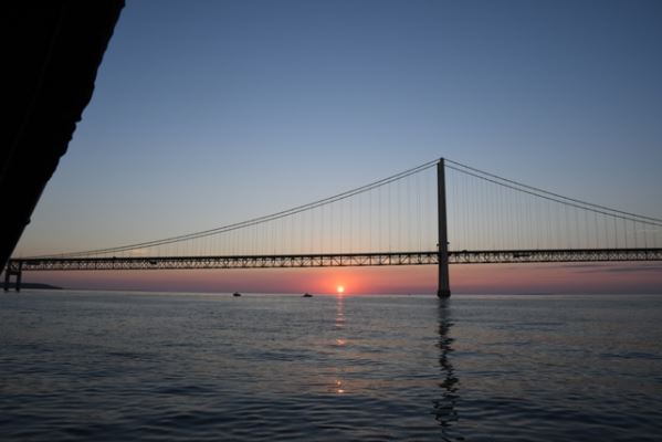 I love it when a plan comes together, but more importantly, I love having a great team and crew that makes this all happen. After swapping the seat cushions and crew we were saying our goodbyes to Duane and John when a pontoon pulled up behind us. It was Travis and a boat load of friends and family. I asked him how he knew we were there and then I remembered that we had had our SPOT satellite tracker going the entire trip so people could follow us on the net and had not yet turned it off. He grinned and, in his fun, joking way said, “you’re done working, now let’s go do some real boating and have some fun on the Island.” With that, we were back on the water. As we made the crossing back to Mackinaw Island, a huge orange and red sun slowly sank into Lake Michigan behind the Mighty Mac. It was picture perfect.